Shotgun Creek
Shotgun Creek near Marcola, Oregon holds coastal cutthroat trout with quiet upper stretches that see fewer anglers.
- 12 miRiver length
- 1Game fish
- 10Access points


 In the FlyFishFinder app
About Shotgun Creek
Shotgun Creek is a small stream near Marcola in Lane County, Oregon. It is part of the Willamette watershed and our map shows about 12 miles of water with 10 mapped access points.
The creek holds coastal cutthroat trout. The lower creek may also see other fish moving in from the Mohawk River. The Shotgun Creek Trail is popular with hikers, but pressure drops off the farther up you go.
Early spring is the best season. Woolly Buggers and egg patterns are local favorites. Mayfly and caddis hatches can show up as it warms, including Blue-Winged Olives and March Browns.
The BLM runs the Shotgun Creek Recreation Site near the lower creek. Mohawk River, Calapooia River and Camp Creek are nearby.
Check the current ODFW regulations and BLM site rules before you fish.
Gages near Shotgun Creek
Is Shotgun Creek fishing today?
See today's top 10 rivers near you, free. Go Premium to score Shotgun Creek, or any gage, on demand.
Other gages nearby
- Mohawk River near Springfield, OR12.0 mi away Not reporting USGS 14165000
- Camp Creek at Camp Creek Road Bridge, near Springfield, OR12.6 mi away Not reporting USGS 14164550
- McKenzie River near Coburg, OR13.2 mi away Not reporting USGS 14165500
- McKenzie River near Walterville, OR13.5 mi away Not reporting USGS 14163900
- McKENZIE RIVER ABV HAYDEN BR, AT SPRINGFIELD, OR13.5 mi away Not reporting USGS 14164900
- Cedar Creek at Springfield, OR13.7 mi away Not reporting USGS 14164700
- South Santiam River near Foster, OR14.0 mi away Not reporting USGS 14187200
- McKenzie River below Leaburg Dam, near Leaburg, OR14.7 mi away Not reporting USGS 14163150
No gages that close. Try a wider radius.
See every gage on the map and today's top 10 rivers in the free appData from the U.S. Geological Survey. Recent readings are provisional and may be revised.
Fish you'll catch
Tap a fish to see every Oregon river that holds it.

Hatching in November
What's on the water in the Willamette watershed this month, and the fly to match.
All 10 hatches this year
Light bars show the season and dark bars the peak. The ringed month is this month.
Tips for fishing Shotgun Creek
-
Walk up the trail
Pressure drops as you move away from the day use area.
-
Fish early spring
This is the season locals fish most.
-
Carry a few buggers
Woolly Buggers cover the water well.
-
Respect the site
Check BLM site hours and fees before you go.
-
Use the map
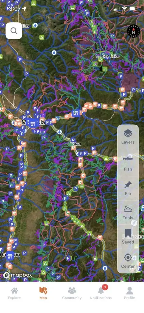
The FlyFishFinder app maps all 10 access points on Shotgun Creek. Free users can see today's top 10 rivers.
Every access point on Shotgun Creek, in your pocket.
- 10 mapped access points, with parking and put-ins
- Today's Fishability score, so you fish the day that lines up
- Bite forecast for the days ahead
Rivers near Shotgun Creek
Shotgun Creek FAQ
What is the best time to fish Shotgun Creek?
Early spring.
Where is Shotgun Creek, Oregon?
Near Marcola in Lane County, about 16 miles northeast of Springfield.
Can you wade Shotgun Creek?
Yes. It is a small stream and most people wade it.
What flies work on Shotgun Creek?
Woolly Buggers and egg patterns are local favorites. Classic mayfly patterns work in hatches. The app shows what is hatching and working today.
What fish live in Shotgun Creek?
Coastal cutthroat trout.
Are there special rules on Shotgun Creek?
Check the current ODFW regulations and BLM site rules before you fish.