Built for how
you actually fish.
Mapped by hand since 2019, paired with live intel that tells you where to go today.


Mapped by hand since 2019, one water at a time.
We built every layer from state DNR datasets, national hydrography, USGS, and many other sources, then called agencies directly for the deeper details. Not auto-generated, and not guessed by users.
That's 220,000+ rivers, public access, regulations, fly shops, and public land, with 30+ layers and filters, including species down to the river.
With Pro, download your water and fish with zero bars. Offline maps work with no cell signal.

Know which rivers are fishing best, right now.
Every time you open or refresh the app, we score live flow, water temperature, pressure, sky, and wind, then rank the best trout water near you.
- Top 10 near you. Ranked, with your best hours on the water.
- Search any trout river. Pick any gage in the country and see instantly whether it's fishable.
- Lit up on the map. Your top 10 glow in their rating color, so the best water stands out at a glance.

- FlowPrime · 49th percentile
- Water51°F · in trout range
- BiteNeutral · pressure steady
Every gage on the map. Free.
Tap any USGS gage to see live flow, how it compares to normal, gage height, and water temperature, plus a 24-hour and 7-day chart. No trial needed.
- Flow vs. normal. See today's percentile against the historical average.
- Flows Nearby. Browse the streams around you, scored on flow alone.
- Straight from USGS. Current readings, not guesses.
Download free and see what's flowing near you.
Fish It
Fish It
Fish It
Fish It
Fish It
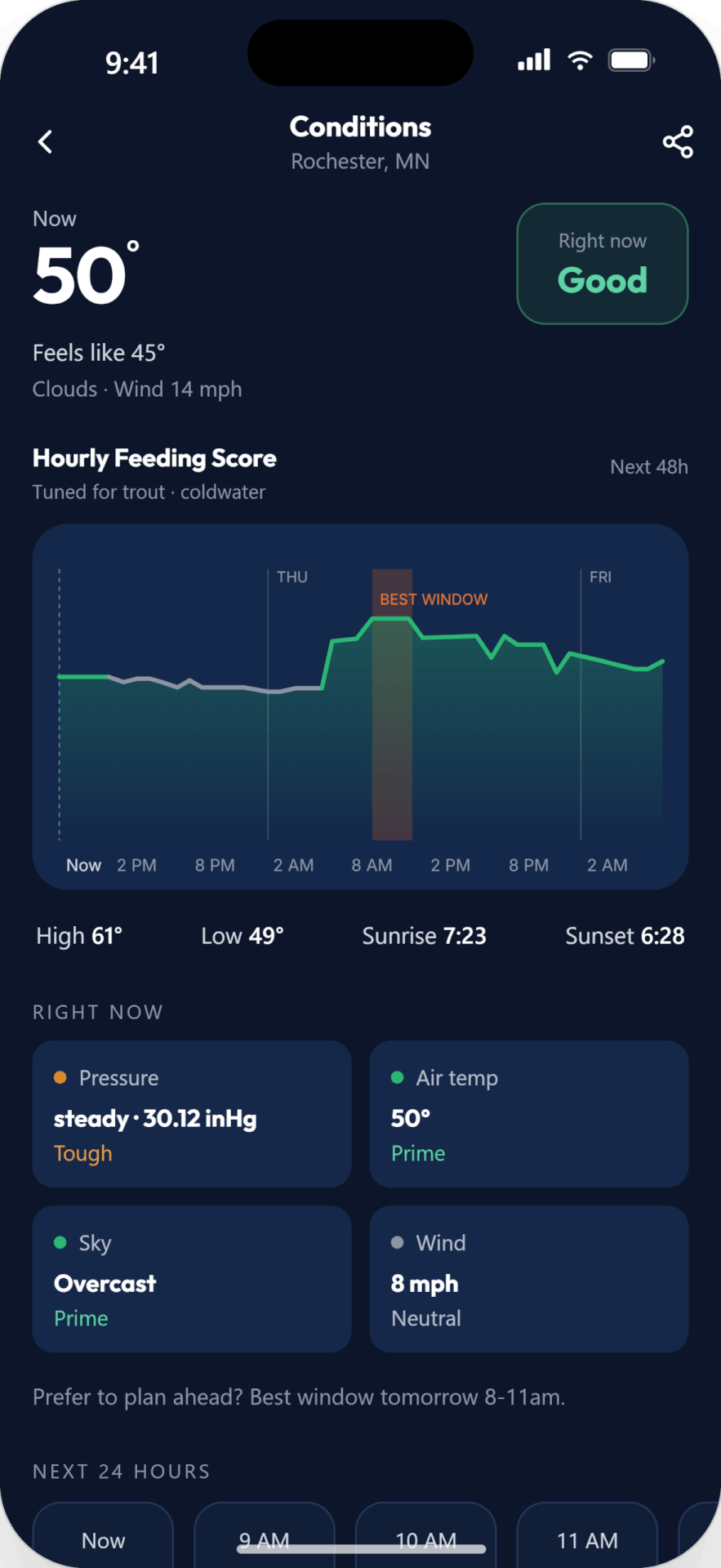
Is the bite on? We'll tell you.
Fish respond to the sky as much as the water. We weigh barometric pressure and its trend, cloud cover, rain, wind, and temperature to call whether fishing looks on or off, and when your best window is.
See anglers near you, and where you're headed.
Connect one to one, swap intel, and plan trips with people who know the water. Your private waypoints and spots stay private, never shown publicly and never sold.
Built for the whole trip.
Public land
BLM, National Forest, state lands, easements, and SWAs in one view.
3D terrain
Read the terrain and plan your approach to tricky access.
Live USGS gages
Real-time flow and height on gages across the country, free.
Pro Picks
Hand-curated waters from local experts, with notes on flies and seasonality.
River miles
Measure a stretch, access to access.
Private waypoints
Save your spots with photos that stay yours.
Offline maps
Download your water and fish with zero bars.
Tracer
Trace your route on the water.
Mark My Spot
Mark your spot on the water in one tap.

See what's prime tonight.
Free to download, with a free trial of Pro. Start scouting water in minutes.